Step into the realm of coordinate systems with our comprehensive cartesian to polar calculator. Dive into the intricacies of Cartesian and polar coordinates, exploring their applications and the art of converting between them.
From the world of physics to the vast expanse of astronomy, uncover the secrets of coordinate systems and their indispensable role in shaping our understanding of the universe.
Cartesian and Polar Coordinate Systems: Cartesian To Polar Calculator
Coordinate systems are essential tools for locating points in space. The two most common coordinate systems are the Cartesian coordinate system and the polar coordinate system.
The Cartesian coordinate system is a two-dimensional coordinate system that uses two perpendicular axes, the x-axis and the y-axis. Each point in the Cartesian coordinate system is identified by two numbers, called the x-coordinate and the y-coordinate.
The polar coordinate system is a two-dimensional coordinate system that uses a point and an angle. The point is called the pole, and the angle is called the polar angle. Each point in the polar coordinate system is identified by two numbers, called the radius and the polar angle.
Applications of Cartesian and Polar Coordinate Systems
Cartesian and polar coordinate systems are used in a wide variety of applications, including:
- Navigation
- Surveying
- Engineering
- Physics
- Computer graphics
Converting Between Cartesian and Polar Coordinates
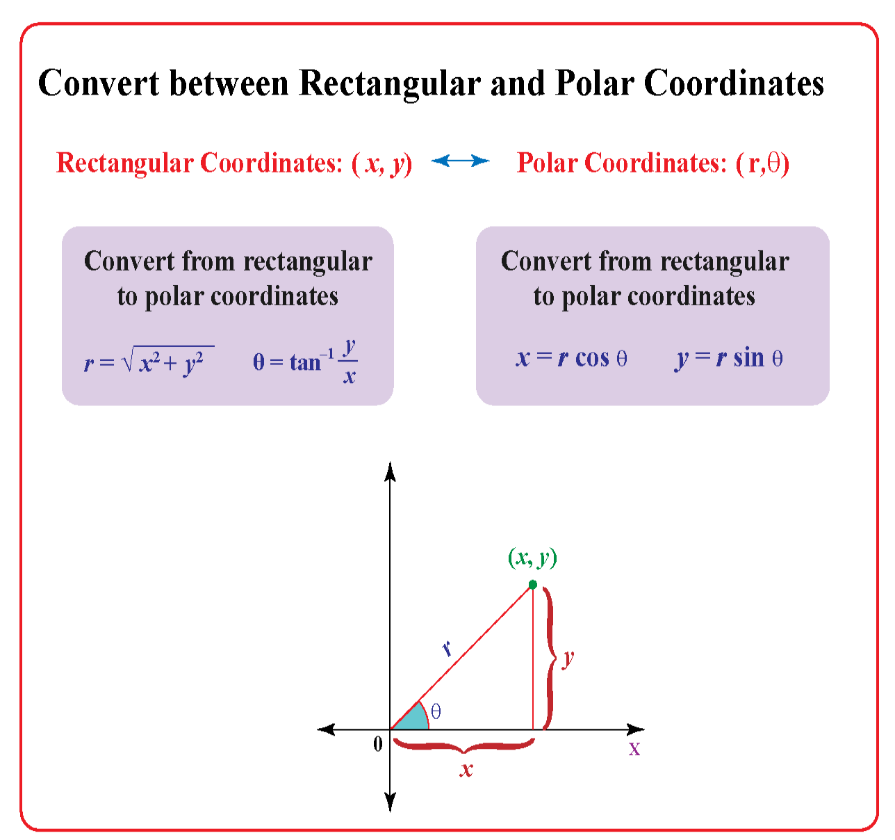
Converting between Cartesian and polar coordinates is essential for understanding and working with points in a two-dimensional plane. Here are the formulas for converting coordinates between the two systems:
Converting from Cartesian to Polar Coordinates
To convert a point from Cartesian coordinates ( x, y) to polar coordinates ( r, θ), use the following formulas:
- r= √( x2+ y2)
- θ= arctan( y/ x)
Converting from Polar to Cartesian Coordinates
To convert a point from polar coordinates ( r, θ) to Cartesian coordinates ( x, y), use the following formulas:
- x= rcos( θ)
- y= rsin( θ)
Example
Convert the point (3, 4) from Cartesian coordinates to polar coordinates.
Using the formulas above, we get:
- r= √(3 2+ 4 2) = 5
- θ= arctan(4 / 3) ≈ 0.9273 radians
Therefore, the point (3, 4) in polar coordinates is (5, 0.9273).
Graphing in Cartesian and Polar Coordinates
Graphing equations in Cartesian and polar coordinates involves different approaches and conventions. Understanding these differences is essential for effectively visualizing and analyzing mathematical relationships.
In Cartesian coordinates, points are represented by ordered pairs (x, y), where x denotes the horizontal coordinate and y denotes the vertical coordinate. The graph is a two-dimensional plane with the x-axis horizontal and the y-axis vertical.
In polar coordinates, points are represented by ordered pairs (r, θ), where r denotes the distance from the origin to the point and θ denotes the angle between the positive x-axis and the line connecting the origin to the point.
The graph is a two-dimensional plane with the origin at the center and the positive x-axis serving as the reference line for measuring angles.
Examples of Graphs, Cartesian to polar calculator
- In Cartesian coordinates, the equation y = x^2 graphs as a parabola opening upwards.
- In polar coordinates, the equation r = 2cos(θ) graphs as a cardioid, a heart-shaped curve.
Applications of Cartesian and Polar Coordinates
Cartesian and polar coordinates find extensive applications in various fields, ranging from physics and engineering to navigation and astronomy. Each system offers unique advantages for representing and analyzing spatial relationships.
Cartesian Coordinates
In physics and engineering, Cartesian coordinates are widely used to describe the motion of objects and solve complex problems involving forces and vectors. For instance, in classical mechanics, the position and velocity of a particle can be conveniently represented using Cartesian coordinates, enabling the calculation of its trajectory and other motion parameters.
Epilogue
As we conclude our exploration of cartesian to polar calculator, we leave you with a newfound appreciation for the power of coordinate systems. May this knowledge serve as a guiding light in your future endeavors, empowering you to navigate the complexities of the world with precision and clarity.